City maps tell a story. It may be the downtown rich in attractions or the urban area full of schools, business, and parks. History and art, commerce and progress play their parts.
Our maps are custom-made. Each map is made to best communicate the city–its attractions, culture, and visual identity.
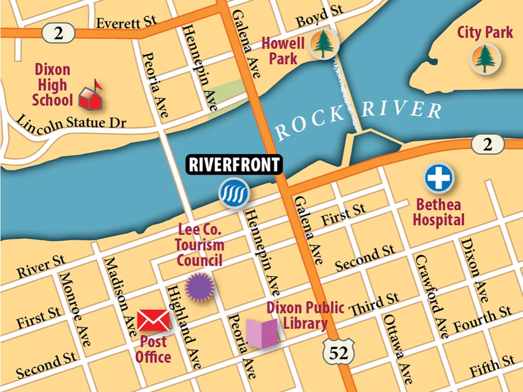
This map of Dixon, Illinois, employs several visual techniques to boost its attractiveness. Drop shadows lift the points-of-interest (POIs), the colors are bright, and the river has a shadowed shore and a waterfall
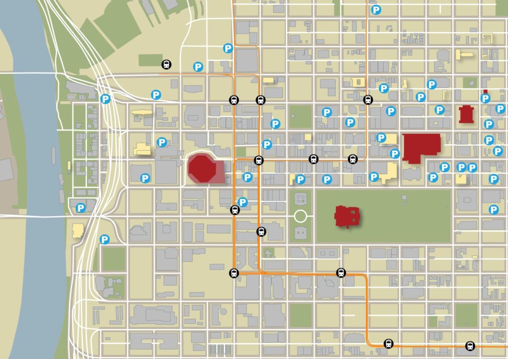
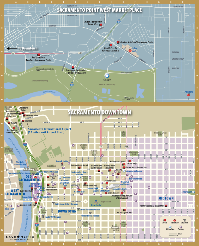
A map image showing building outlines, hotels (in yellow), and public parking in Downtown Sacramento.
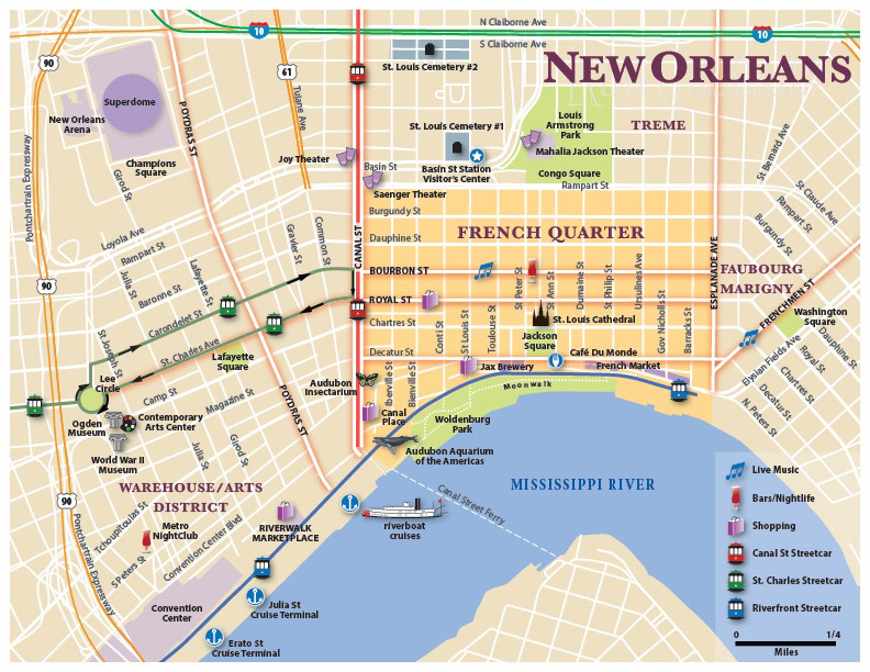
This hotel map of New Orleans features a numbered index set against a semi-transparent background
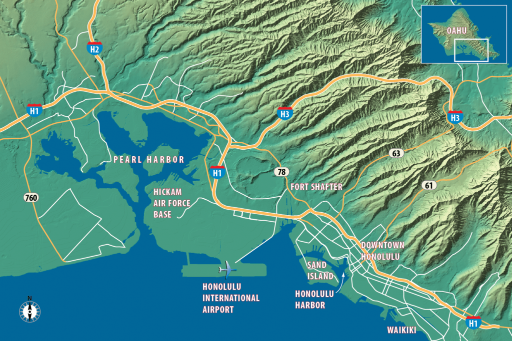
Hawaii’s rugged volcanic terrain attracts sight-seers and provides an orientation to the cities and attractions on the islands. This location map of Oahu emphasizes the terrain and shows major roads and destination on the island. It was part of a commercial real estate project for CBRE
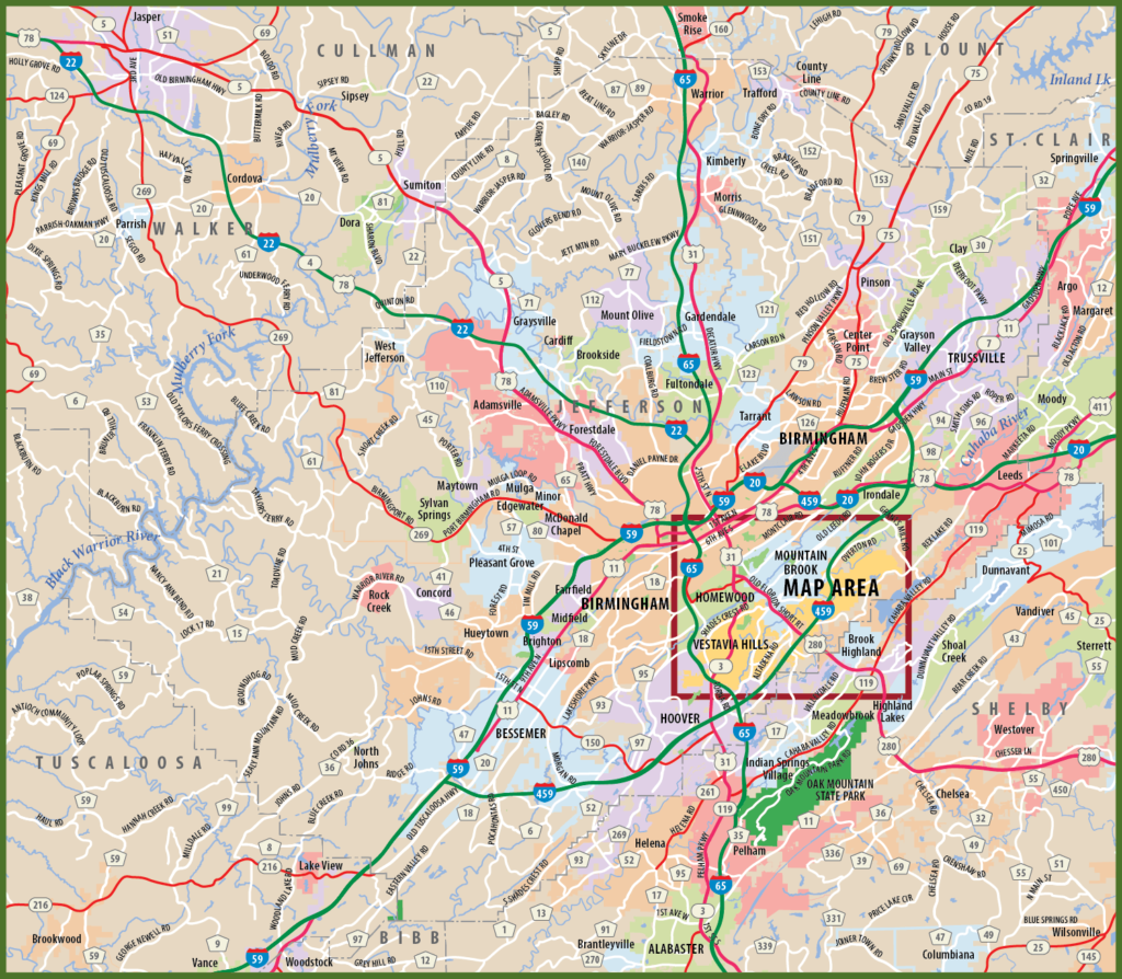
The Greater Birmingham area is shown to provide context for the map of Vestavia Hills, Alabama. Many of our Chamber of Commerce clients require a close-up city map and an overview area map. We make maps using available GIS data, from city, county, state, and federal agencies. That assures accuracy.
The Sacramento CVB makes full use of our maps. Many of our maps are re-purposed for conventions and events. Because our maps are built to be edited, we can quickly turn one map into another, to help serve a CVB’s active mission.
On the first Saturday in October, Downtown Madison holds its annual Street Festival. One of the most popular events in a small city in the South, this festival features a day full of food trucks, retail sales booths, bands, and extensive art and craft areas.
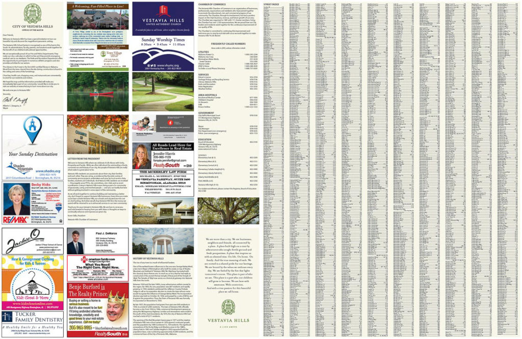
Map side of the Vestavia Hills, Alabama Chamber of Commerce map
Advertising side of the Vestavia Hills, Alabama Chamber of Commerce map.
Who uses city maps?
Our city maps find their way into visitor guides, chamber maps, and tourism websites. The hospitality industry also requests maps. They show the resources around locations to assist their guests in accessing all that a city offers.
But not all city maps cater to visitors. We’ve made maps for commercial real estate companies and health care networks.
Some maps cover a whole city while others focus on a neighborhood or a small area around a popular attraction.
An effective city map
What makes for an effective map? Information and design.
To accomplish this, we base maps on GIS data. That means roads, points-of-interest and areas are accurate and complete.
In addition, we use professional graphic design to “paint” the map with appealing color and icons. Our clients often want their maps to fit into the family of their other communications. So we try to use print and web colors throughout the map to tie it to a client’s branding.
Also, check out our Tourism Maps page. You’ll see more examples of maps designed for visitors.