Maps for resorts must be colorful, clear, and inviting. The resort map is a key ingredient in hospitality. We make different styles of resort maps. Each map is customized to the resort.
Resorts, like city parks and recreation areas, compress a lot of activity into a small geographic area. While their areas are usually homogenous, resorts offer activities and recreation resources that are anything but uniform.
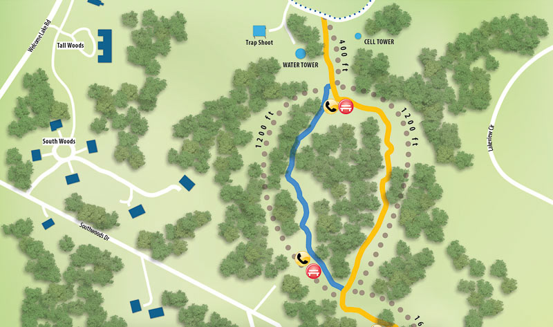
When Woodloch contacted us about creating three maps for their resort in the Pocono Mountains near Hawley, Pennsylvania, we responded with a proposal to mix accurate, GIS mapping with a naturalistic visual design.
Let’s see why both values—accuracy and artistry—are important in a project like this.
GIS
When we create a map, we first build a geospatial framework by importing GIS data. This allows us to import data from diverse sources (local, state, federal) and assure that they all precisely fit together in the map. Woodloch’s maps began with imported data for transportation, rivers, and lakes. Because the available data was not detailed enough to show features for the resort such as buildings, trails, tennis courts, and play areas, we created our own data for these features within the accurate geospatial framework of the imported data.
To create data, we used satellite imagery that fit within our geospatial framework. We drew buildings and tennis courts and other recreation features in accurate size and positioning relative to the other map features whose data we imported.
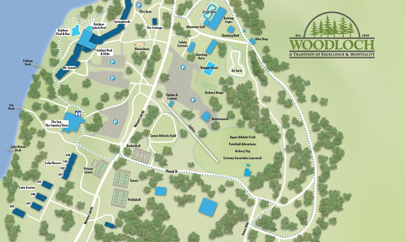
An important variable in mapping is picking a proper map projection. For Woodloch, we chose a Mercator projection. This would help the resort later when planning new resort features or updating the maps with their own graphics staff. Using the Mercator projection meant that screenshots taken from Google Maps (map or satellite imagery) could be set underneath the map artwork in Adobe Illustrator and new features drawn in accurate spatial size and positioning. This can prove an economical benefit because it doesn’t require mapping software and expertise to update the map. A graphic artist equipped with a web browser and Adobe Illustrator can edit the map files.
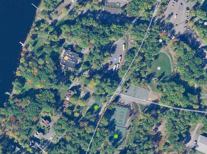
Building the maps from GIS data afforded another benefit. Resort visitors could easily compare the resort’s printed and display maps with their smartphones’ Google or Apple maps to see their location and explore the resort’s nearby recreation features.
The old map we were replacing was an artistic rendition in which direction and scale were sacrificed to fit the two resort properties onto a single page. Our challenge was to keep the map accurate while filling the printed dimensions efficiently.
Naturalistic Imagery
A map has to communicate visually. Its symbology must be pictorial enough to identify what is where when a resort visitor glances briefly at the maps.
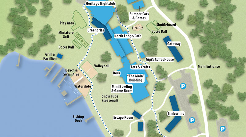
We drew tennis courts, athletic fields, go-cart tracks, miniature golf holes, and an archery range from satellite imagery to get accurate size and location. Then, in Adobe Illustrator, we used textures and transparency to give each feature its identifiable character. Parking lots, for example, were given a texture to set them apart from other map areas. We could have simply applied different flat colors to differentiate parking lots from other resort areas. But textures provide a more organic or natural look making a more sophisticated product.
A key attraction is a resort’s natural habitat. Woodloch is filled with trees. We wanted to convey the wooded nature of the resort but do it in a graphical way minimizing visual clutter.
To accomplish this, we turned to Corel Painter software and its Image Hose tool. This tool sprays treetop images in a different sizes and orientations. With subtle drop shadows, the trees help give the graphics of the map a 3D appearance. To see the resort features as we created the trees, we first created a high-resolution raster copy of the map to use as a background in Painter as we placed the trees with the Image Hose tool and tried not to overrun the more important map features like buildings, trails, and recreation assets.
Other Considerations
Maps are not stand-alone creations. They share visual space with other resort materials, from web pages to brochures. Colors and fonts and overall feel should harmonize with resort signage as well as its web and printed materials.
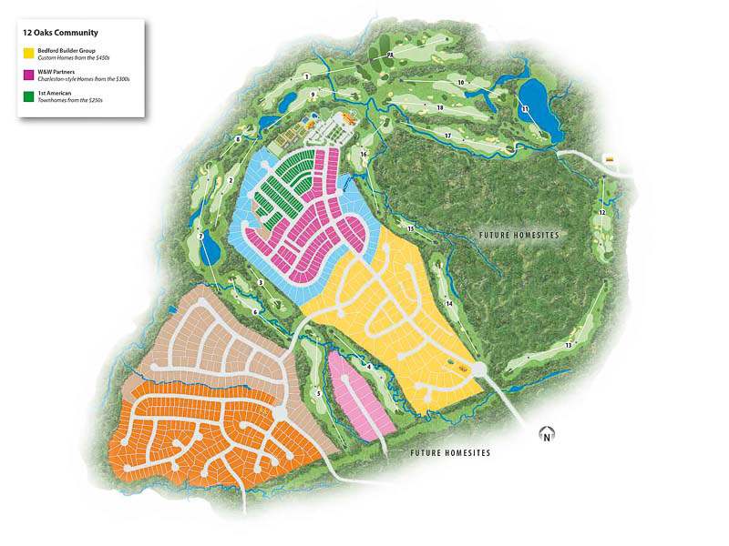
Depending on the level-of-detail desired by the client, we can produce highly realistic site maps. This capability plays out well for detailed maps of golf courses and new real estate developments.
The Big 4 series of parks in Australia provide places where campers can relax and enjoy a myriad of activities. The goal of our Big 4 Saltwater at Yampa map was to clearly show the activities and attractions at this park. Park maps have other goals, too. One is to provide information such as emergency numbers, times of operations, and links to related websites. Another goal is to have graphics–type, colors, symbols–that attract viewers. A high-quality map invites interaction, even if the map appears in print.

For price and design information for your resort map, please email us.